Survey & Spatial
Surveying, UAV mapping, LiDAR and spatial data for mining, civil, infrastructure, renewable energy and rehabilitation projects — field acquisition through to engineering and GIS-ready deliverables.
Learn moreDrone LiDAR Survey & Canopy Analysis
Zenmuse L3 laser scanning on the DJI Matrice 400 — terrain recovered beneath the canopy, and the vegetation above it classified and segmented to the individual tree.
Learn moreMultispectral & Vegetation Analytics
A dedicated DJI Mavic 3 Multispectral sensor — NIR, red-edge, red and green bands — computed into NDVI and related indices to map vegetation vigour, density and stress.
Learn moreDrone Thermal Survey & Fauna Detection
Radiometric thermal on the Matrice 400 and Matrice 4T, flown day or night — hot-spot and asset inspection, and heat-signature detection of koalas, gliders and other cryptic fauna with nest-box screening.
Learn moreSolar PV Thermography
Aerial radiometric thermal and RGB inspection of photovoltaic plants — every module, referenced to block, row and string, delivered as an anomaly register your O&M team can act on.
Learn moreUAV Asset Inspection
Close-visual, radiometric thermal and LiDAR inspection of structures and plant — no one at height, no shutdown for access, every finding located and rated in a defect register.
Learn moreMine Rehabilitation Seeding, Offsets & Environmental
Offset and rehabilitation country managed end-to-end — baseline and repeat condition survey, declared-weed mapping and control, and reporting aligned to OAMP and EPBC obligations.
Learn moreDrone Weed Spraying & Weed Control
Detection, chemistry, application, verification and reporting inside one CASA-certified operation — aerial, ground, handheld and mechanical, matched to species, density and terrain.
Learn moreTraining
Onsite drone training for commercial operators stepping up to DJI Agras and enterprise platforms — including CASA and ChemCert pathway support.
Learn moreOne crew, from first flight to final report.
Drone and ground-based weed control, aerial survey and mapping, multispectral and thermal analytics and compliance reporting — together under one CASA-certified operation. From a single mobilisation we can survey a site, map an infestation, treat it and report it: safe, accurate and auditable land-management outcomes for mining, government, environmental and agricultural clients, without handing work down a chain of subcontractors.
Closed-loop weed control
Most providers do one end of this. We do all three: map the weeds wall-to-wall, treat them with rate-controlled application, and hand back the record.
Detect
Wall-to-wall aerial weed mapping over a survey-grade orthomosaic.
Treat
Variable-rate application — DJI Agras T100 aerial and GPS-guided ground units — held on-target.
Record
GPS spray records, product rates and treatment maps for every job.
Run as a program, not a visit. Baseline detection sets the treatment plan, every application is verified against it from GPS as-applied records, regrowth is monitored round-on-round against the baseline, and follow-up treatment is scheduled until control is achieved.
Built for your GIS and survey environment
- Coordinate system
- Delivered in your nominated datum and projection — e.g. GDA2020, MGA Zone 55 / 56. We work to your coordinate system, not ours.
- Accuracy & control
- RTK / PPK georeferencing with surveyed ground control and independent checkpoints; orthomosaics down to 0.2 cm/pixel GSD (typically 1.5–2.5 cm for broadacre survey), accuracy verified and reported per project.
- Formats
- Raster (GeoTIFF / ECW), vector / GIS (SHP, GeoPackage, KML / KMZ) with attribution and areas, CAD (DWG / DXF), point cloud (LAS / LAZ), plus CSV and PDF map products.
- Certification
- Survey-grade outputs certified by our RPEQ surveyor; environmental deliverables reviewed by our ecologist / Suitably Qualified Person.
- Data handling
- All project data held commercial-in-confidence; deliverable ownership and access arrangements set per engagement.
Owned and field-ready
- DJI Matrice 400 — heavy-lift survey & inspection · Phase One iXM · Zenmuse H30T · Zenmuse L3 LiDAR
- DJI Matrice 4T — thermal & rapid inspection
- DJI Mavic 3 Multispectral — NDVI / indices
- DJI Agras T100 — aerial spray & spreading
- GPS-enabled UTV spray units; boom and spot-spray equipment
- Handheld and knapsack units; chainsaw / cut-stump treatment
- GPS tracking, mapping & GIS software; spray-diary and application recording
- Field tablets and digital reporting; mine-compliant vehicles; DG storage
Harrisia cactus control across a 560 ha environmental offset
A 560 ha riparian offset in the Bowen Basin, evidenced to compliance standard: high-resolution aerial survey to find every infestation, variable-rate application to treat it, and as-applied records to prove it — over four campaigns.
Every figure drawn directly from the survey and as-applied application records. Site and client details withheld; full records available on request.
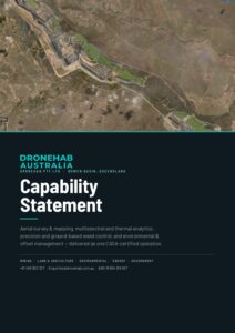 Capability Statement 2026 Services, fleet, credentials, prequalification and track record — the full procurement document.
 Thermal Fauna Detection Capability 2026 Koala thermal detection and nest-box monitoring — method, evidence standard and field results. Survey & Spatial Capability 2026 Mine and earthworks survey, UAV LiDAR, volumes, as-builts and GIS delivery — method, case example, systems and credentials. Solar PV Thermography Capability 2026 Aerial radiometric thermal inspection of PV plants to IEC TS 62446-3 — findings, classification, method and deliverables. UAV Asset Inspection Capability 2026 Close-visual, radiometric thermal and LiDAR inspection of structures and plant — scope, sensors, method, deliverables and credentials.