Active laser scanning — the Zenmuse L3 flown on the DJI Matrice 400 — measures the ground and the vegetation above it in one pass. Returns reach through gaps in the canopy to recover the terrain beneath, and the cloud itself is classified and segmented: canopy height and structure resolved to the individual tree, each crown isolated and measurable.
LiDAR flies on the same Matrice 400 platform as our photogrammetry survey, so a laser pass can be added to a survey mobilisation where true ground under vegetation or canopy structure is the question.
Zenmuse L3 on the Matrice 400 — high-density laser scanning.
Classified point cloud (LAS / LAZ), DTM / DSM, canopy height model, individual-tree segmentation, contours.
Terrain under vegetation, canopy structure, offset and rehabilitation monitoring.
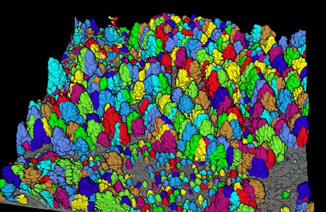

Ground and canopy, separated
Terrain
- Classified point cloud — ground returns separated from vegetation
- Digital terrain model beneath the canopy (DTM)
- Digital surface model (DSM)
- Contours to your interval
Canopy & vegetation
- Canopy height model
- Individual-tree segmentation — each crown isolated and measurable
- Canopy structure across the survey area
- Round-on-round comparison for offset and rehabilitation monitoring
ApplicationsTerrain under vegetation · canopy structure · offset and rehabilitation monitoring · landform under regrowth.
Built for your GIS and survey environment
- Coordinate system
- Delivered in your nominated datum and projection — e.g. GDA2020, MGA Zone 55 / 56. We work to your coordinate system, not ours.
- Accuracy & control
- RTK / PPK georeferencing with surveyed ground control and independent checkpoints; orthomosaics down to 0.2 cm/pixel GSD (typically 1.5–2.5 cm for broadacre survey), accuracy verified and reported per project.
- Formats
- Raster (GeoTIFF / ECW), vector / GIS (SHP, GeoPackage, KML / KMZ) with attribution and areas, CAD (DWG / DXF), point cloud (LAS / LAZ), plus CSV and PDF map products.
- Certification
- Survey-grade outputs certified by our RPEQ surveyor; environmental deliverables reviewed by our ecologist / Suitably Qualified Person.
- Data handling
- All project data held commercial-in-confidence; deliverable ownership and access arrangements set per engagement.