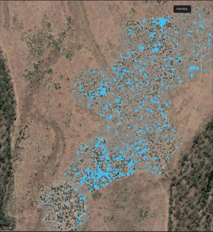
A resource-sector client needed Harrisia cactus (a declared weed) controlled across a 560 ha environmental offset along a riparian corridor — with works evidenced to compliance standard. Dronehab delivered the full loop: high-resolution aerial survey to find every infestation, variable-rate application to treat it, and as-applied records to prove it.

What was done
- Target species
- Harrisia cactus (declared) — scattered infestation across riparian and offset country.
- Treatment
- Grazon Extra + Hasten Oil + metsulfuron; variable-rate, water rate matched to density per block.
- Offset
- 560 ha environmental offset along a riparian corridor, surveyed wall-to-wall at 1.4 cm/px.
- Campaigns
- 4 rounds, Apr–Jul 2024, each verified against the survey baseline.
- Verification
- GPS as-applied records per pass — 0.008 ha over-target and 0.00 ha under-target across the program.
- Deliverables
- Weed maps (GIS), as-applied coverage maps, product and rate records, treatment summary for compliance reporting.
Detect, treat, record
Detect
Wall-to-wall aerial weed mapping across the 560 ha offset over a survey-grade orthomosaic at 1.4 cm/px, each infestation species-attributed with area.
Treat
Variable-rate application, water rate matched to infestation density per block, held on-target and recorded pass by pass.
Record
GPS as-applied records, product and rate data and treatment maps returned after every campaign for verification and compliance reporting.
Every figure on this page is drawn directly from the survey and as-applied application records for this program. Site and client details withheld; full records available on request.